16.07.2025
In May 2025, the international Earth system science community came together for the Global Kilometer-Scale Hackathon, a week-long, distributed event designed to accelerate collaboration around high-resolution Earth system modelling. Hosted across multiple nodes worldwide, the hackathon focused on the analysis of kilometre-scale storm-resolving models and how these can improve our understanding of complex Earth processes. At the ESA node in Frascati, participants worked at the interface between satellite observations and climate model outputs, fostering collaboration between observational scientists and modelling groups to explore how satellite data - particularly from missions like EarthCARE - can inform model evaluation. This approach offers a powerful means of directly comparing model simulations with observations: a key step toward ESMO’s vision of tightly integrating Earth system models and satellite data. In this interview, we speak with Karsten Peters-von Gehlen, who participated at the Frascati node, about the work done, its significance for ESMO, and the path forward.
Can you walk us through the specific objectives and activities you were involved in at the ESA Frascati node during the Global km-scale Hackathon?
Absolutely. I was invited to join the ESA Frascati node by Bjorn Stevens, primarily because of my background with model and satellite data, which I’ve worked extensively with during my PhD and postdoc. The team was looking for someone who could bridge the gap between observational data and state-of-the-art modeling, especially in the context of the new EarthCARE satellite, which became operational July 2024.
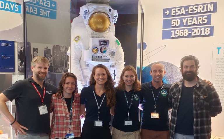
When I arrived, the main objective became clear: to explore how EarthCARE’s newly released data products could be integrated with high-resolution model data in a hackathon setting. The challenge was to see whether our current tools and workflows, designed largely for working with large-scale, centralized model datasets, could be effectively adapted to datasets deriving from satellite-based measurements. Our team in Frascati consisted of six people, including our PI, Saskia Brose, three postdocs who were already working with EarthCARE data, a developer I coincidentally knew from my Max Planck days, and myself. It was a small, focused group, which made collaboration quite fluid.
One of the key contributions I made was helping ESA colleagues better understand model data. At one point, they wanted to directly compare specific features between the model outputs and satellite observations. I explained how coupled simulations work and why e.g. model timestamps (like April 15 or December 2020) don't always align with real-world events. These nuances are critical when interpreting and comparing datasets.
Even if the hackathon team was relatively isolated from the broader ESA staff, whenever we would interact with other employees people were always curious and the reactions were overwhelmingly positive once we explained about the Hackathon and what we were doing. It became clear that one of the implicit goals of the event was to connect the people who design satellite instruments and data pipelines with the scientists who actually use that data. That kind of interaction doesn’t happen often enough, and it was rewarding to be part of that bridge.
What’s so special about Earth Care and its data?
EarthCARE is a remarkably sophisticated satellite: it's the result of more than two decades of planning. In fact, it was already being discussed in concrete terms during my PhD back in the early 2000s. It brings something genuinely unique to Earth observation science.
What makes EarthCARE special is that it was specifically designed to study the complex interactions between clouds and aerosols. It doesn't just take images, it carries a suite of advanced instruments all mounted on a single platform. This includes a radar for cloud profiling and a lidar for aerosol detection. The fact that these instruments are all on the same satellite allows for perfectly co-located measurements.
Another reason EarthCARE is so significant is its direct link with recent airborne campaigns. For instance, the PERUSION campaign over the tropical Atlantic. It was partly funded by ESA specifically to help evaluate EarthCARE data. Every HALO flight during that campaign was planned to fly directly underneath the satellite’s path at some point, enabling near-simultaneous comparisons between in-situ aircraft measurements and satellite observations.
This synergy between HALO and EarthCARE provides a uniquely valuable dataset for validating satellite products and for improving model evaluation. It’s not just about how realistic a model seems; it’s about using observational data like this to challenge and refine what we think we know.
The ESA Frascati team worked closely with modelling teams to align analysis strategies. Can you describe how this collaboration unfolded during the hackathon, and what insights it led to? What kind of comparisons were you able to make between model and satellite data?
The collaboration really kicked off on the first day during the introductory session. Teams were encouraged to reach out to us if they thought satellite data could support their work. Most of the coordination happened through Mattermost channels, with each team explaining what they were working on, what parameters they wanted to analyze, and what they hoped to achieve.
The overall idea was to see if the kinds of analyses that modeling teams were doing with their data could be replicated or complemented using satellite data from EarthCARE. For example, one group focused on stratocumulus clouds off the coast of Namibia. They were looking at parameters like liquid water path and albedo, and our job was to identify what EarthCARE instruments and data products could be used to support or benchmark their analyses. That’s where the collaboration got interesting. Satellite and model variables don’t always align neatly, so I helped guide the ESA colleagues in identifying the right satellite parameters for comparison. It can be tricky: there are uncertainties, naming inconsistencies, and sometimes it's just not obvious how to match variables. But in the end, it worked out well. We managed to overlay EarthCARE data with model output on the same plot, just a simple line among other lines, but it was striking to see how well they matched. That kind of result, even if small, validates both the observational approach and the modeling work.
Another group was looking at dust storms in the Sahara. Finding these in EarthCARE’s data was incredibly challenging. We had to manually sift through imagery from a geostationary satellite, frame by frame, to identify potential dust storms. And even when we found one, the next question was: did EarthCARE fly over it? Often the answer was no, the satellite’s path would be hundreds of kilometers off. But eventually, we found a good case where EarthCARE’s track aligned with a visible dust storm. The vertical profile of both dust and cloud in that event was excellent, and it became a strong example for model comparison.
Overall, the hackathon showed that real synergy is possible between modelers and satellite data users.
What were some of the challenges or surprises you encountered in making satellite observations and model outputs more directly comparable?
One of the first things we realized was that accessing and working with the satellite data wasn’t as straightforward as we had hoped. During the hackathon, we tested a new platform called ESA MAAP, a kind of virtual environment similar to a JupyterHub, but tailored for working with satellite data. It was still in a relatively early stage, and while it had a data catalog with some EarthCARE datasets, we ran into issues with authentication, token access, and data-sharing restrictions. The data could only be used locally and wasn’t permitted to be distributed, which made collaboration across different hackathon nodes difficult.
Beyond the technical side, there was also the challenge of bridging the understanding between the satellite and modeling communities. The data products and their intended uses don’t always align intuitively, and it took some back-and-forth to figure out which satellite variables could be meaningfully compared with model outputs.
Still, despite being a small team, we definitely felt like we were part of something larger. And considering that this was ESA’s first time taking part in a hackathon, I think the experience gained will be very helpful in the future. The event was externally organized, and we could focus more on the science and less on logistics, which made for a positive experience overall.
From a technical perspective, what specific advantages did the hackathon environment offer that enabled the group to achieve things you wouldn’t have been able to do as easily in a regular research setting?
The hackathon environment offered something quite unique, an opportunity to focus intensely on a single topic for several consecutive days, which is a rare luxury in day-to-day academic or research life. That kind of uninterrupted concentration, even just over two or three days, enables a level of deep exploration that often leads to insights you wouldn't arrive at otherwise. It also creates a collaborative dynamic that’s hard to replicate in regular settings.
Of course, one week isn’t enough to finish a full research paper, and I don’t think anyone expects that. But what the hackathon does provide is the spark, the foundation for ideas and collaborations that can be developed further afterward. It’s about testing what’s possible with the data and tools you have at hand.
For ESA specifically, I think it was an eye-opener in terms of understanding how their data is used by the broader scientific community. They saw firsthand the technical and practical barriers to data access and how those obstacles can limit engagement. That kind of direct feedback loop wouldn’t happen as naturally in a more traditional setting.
How can this closer collaboration be continued beyond the framework of the hackathon?
The collaboration between the modeling community and ESA is definitely set to continue, and there’s a strong intention on both sides to build something more sustained and meaningful. One of the key next steps will be figuring out how to navigate the data and licensing issues: these are essential to clarify if we want to make EarthCARE data more broadly accessible. For example, if DKRZ (the German Climate Computing Center) wanted to host a subset of EarthCARE data for its users, we’d need to know whether that’s even permissible. Can someone download ESA data and then redistribute it through another platform? That’s still an open question.
Encouragingly, the hackathon seems to have generated real momentum. It served as an excellent starting point, and we’ve seen support for this collaboration from high up within ESA’s management. That kind of backing is crucial: it helps push things forward and turn ideas into action. Importantly, ESA also seems to recognize that expanding their user base beyond the traditional satellite science community is a win for everyone. Engaging with modelers and broader scientific users not only increases the relevance of their data but also enhances its scientific impact.
So yes, we definitely see this as the beginning of something longer-term. The interest is there, the use cases are clear, and now it’s about building the structures to support it.
What was the highlight of the week for you?
Outside of the technical work, I really appreciated the day-to-day rhythm of the Frascati campus. Each morning started with a walk to the onsite coffee bar (Italy does coffee breaks well) and we’d typically have two or three breaks a day there. It was a simple but meaningful way to connect informally with colleagues and ease into the day’s work.
But the real highlight for me was the unique location where we worked. We were based in this small, octagon-shaped glass hut nestled among olive trees, something straight out of a Hobbit village. It felt surreal to be working in such a peaceful, almost whimsical setting, right in the middle of the high-security European Space Agency campus.